
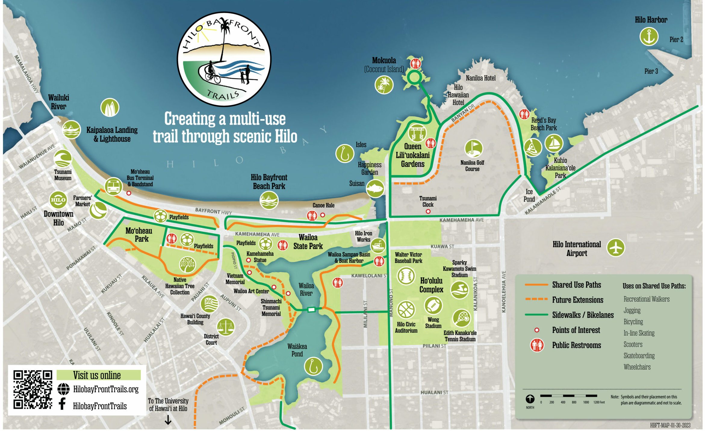
The Hilo Bayfront Trails project is being developed section by section as funding becomes available (see map). The entire system may be envisioned as a series of lei, linked in loops and tying together our community’s history, scenery, recreational activities and the exquisite open space areas fronting Hilo Bay. The sections are numbered for convenience, but they may be built out of sequence and/or simultaneously, as opportunities for partnerships and funding arise.
Segment 1 – Bayfront Trail – Mo’oheau to Wailoa Bridge
Segment 2 – Bayfront Soccer Fields – Waiolama Canal Loop and Downtown Connection
Segment 3 – Wailoa State Park – Pavilion Side (East side)
Segment 4 – Wailoa State Park – Tsunami Memorial Side (West side)
Segment 5 – Wailoa State Park – Kilauea Avenue to Maile Street Connection (South side)
Segment 6 – Waiakea Stream – Kilauea Avenue to UHH Connection
Segment 7 – Waiakea Peninsula – Banyan Drive Interior Loop